The Crinoline and Macalister River the easy way
Duration: 2 days (12km walk, 17km paddle)
Gauge: Licola 2.04m
Here’s a quick trip report for an overnight trip to the top of the Crinoline and down the Macalister river near Licola in the Victorian Alps that Matt and I did in October this year. It may be of interest to some Victorian pack rafters given Licola’s proximity to Melbourne etc.
The original concept was to walk up the Crinoline and over Long Hill then following a spur down to the conjunction of the Macalister and Caledonia rivers, allowing 3 days as I’d not heard of anyone doing this route. Indeed info beyond the Crinoline was a little slim and suggested much regrowth and hard going once off the main track, not much drinking water and possibly a shallow river for some distance from the confluence. Given this Plan B was to top out on the Crinoline and then back track a bit and follow the old Macmillan track to the Macalister river about 7km below the confluence.
I met Matt in Licola on the Monday evening and we camped in one of the many roadside camping spots along the Wellington river a few kms up the road from Licola. Bad weather had delayed our trip but the river levels looked good, although not as high as we thought given the recent rains and floddoing in nearby rivers. The following morning we left a car at Licola and made our way to the Breakfast Creek track for the start of our walk. The track is a steady uphill grind for about 3.5km to a flattish section where we were able to scope out the possible decent via the MacMilliam track. This track was pretty much non-existent but the ridgeline was obvious. The weather was cold with intermittent showers between sunshine. We decided to push on with packs for the further 2.5km to the Crinoline and see how we were going as it was now midday after a late-ish starts. The walk to the top of the Crinoline was very pleasant along an obvious pad and track with a lovely summit view. We did appear to have enough time to attempt the route to the Caledonia but weren’t sure we’d make the river that night. Occasional sleet flurries and a pair of super slippy shoes on my part helped make the call for the easier plan B down to the river. We back tracked to the junction and followed the ridge to the river and a nice camping flat. The way down was indistinct although occasional marked with tape and old tags. As mentioned it was all pretty obvious from the map though and the scrub was fine. It was almost 5pm when we hit the river, we toyed with heading upstream but the 12km for the day was enough and the river looked flat for the next couple of kms upstream anyway.
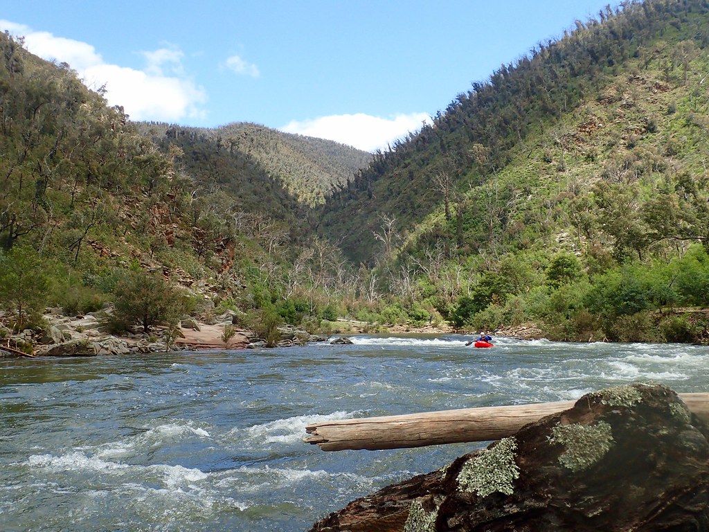
Next morning we were in the boats around 9am , there was enough water to produce good flows. The river was a lot of fun and quite scenic with many small races and rapids, everything boat scoutable although we did check out a couple around bends or to take photos. At the heights we had the river presented plenty of moving water with nothing too technical or harder than PR2. Apparently the river has a reputation for wood but we had no issues. We reached Licola by lunch, a little less than 4 hours for the 16+km traveled, and toyed with just paddling on down to Cheynes bridge. However after lunch it really rained and I was really cold without a dry suit so instead we camped at Cheynes ridge that night and the following day paddled the Macalister gorge section as a day trip. This also is a very nice easy paddle with a couple of PR2’s and a bunch of easier races. To be honest it was fair easier than we were expecting and we were half way through the gorge before realizing. Nonetheless a fun day out.
Personally I love most the opportunity to take in a peak and paddle a river in the one trip and suggest this trip makes for an excellent overnighter for a novice pack rafter particularly new to paddling with a pack. The walk is fun and not too hard and the river is a lot of fun providing plenty of easy white water. Only caveat being if you were unfortunate enough to come out it may take some time to get back in though as there isn’t that many flat bits and of course the wood situation would be ever changing and needs caution. Not sure how low would be OK but I suspect 1.95m up on the Licola gauge should be OK
I suspect the original option of going over Long Hill would be even better (and at the heights we had would be paddle-able from the confluence) probably still do-able in two long days. You can also easily paddle to Cheynes bridge to extend the trip a day although the section to Basin Flat was mainly through farmland and not very exciting looking. The SV map Tali Karng-Moroka suffices for the trip
Some pics and vids at:
Cheers
Mick
