Overview
Stats: ~140 paddling miles, 30 hiking miles, 0 car shuttling!!
We had just finished planning our backpacking trip to the Beartooths (and gotten my time off approved for the week) when my partner messaged me about a snagging a cancelation permit on the Main Salmon:
Some quick googling revealed that the ranger station closed at 4:30pm the following day, so if we wanted to be able to take advantage of these super-rare permits we had to hop!! It’s about a 3.5hr drive from Missoula to Corn Creek, so after an evening and morning of looking at maps, inventorying / supplementing our backpacking food stash, and checking our way down our trip checklist, we hit the road by 11am. We also had to pick up the river guidebooks and print our Main Salmon & Big Creek tributary permits.
The trip had been on our radar for a while, and we were extra stoked after a crew we knew did it pre permit season this June. We were fortunate to be able to get them on the phone and talk thru some of their logistics & timing, in addition to reviewing Forrest McCarthy’s excellent blog.
Day 1: Big drive, little paddle
Driving miles: 164
Paddilng miles: 12
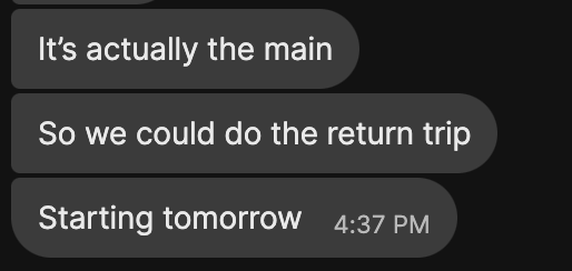
We were pleasantly surprised at how excited the rangers were to see us rolling in to get checked out at Corn Creek, probably out of relief that the cancellation with 24 hours of notice was actually getting used! The checkout process & ranger talk was quite smooth, although it’s a bummer that this river system doesn’t allow small watercraft exemptions for things like firepan requirements. The boat ramp traffic was starting to pick up with people rigging for a launch the following day so we had to bump elbows a bit with the big boaters before pushing off onto the Main.
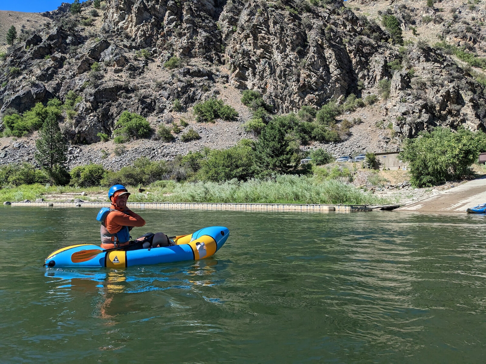
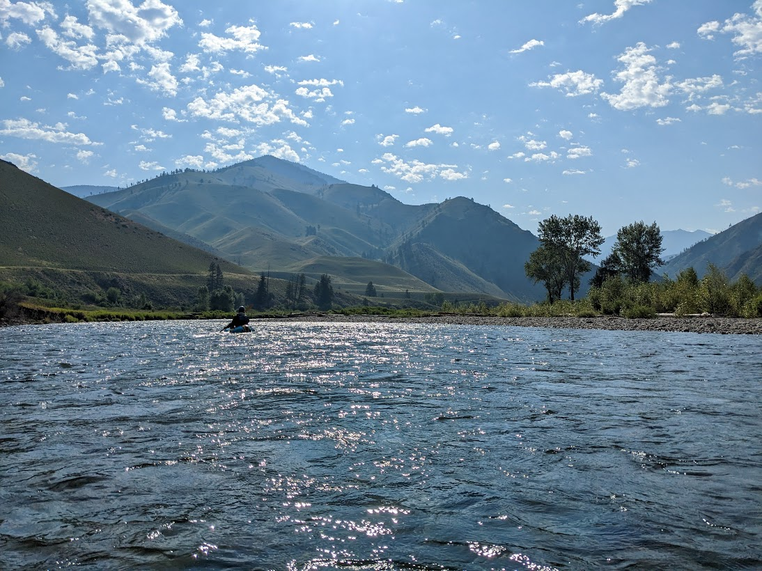
Owen at the ramp
Sasha across from the ramp
The water was running about 4500cfs so we were moving pretty quickly. Neither of us had paddled any of these stretches of the Salmon before, and didn’t have a great sense of the difficulty of the rapids. It was around 5pm when we launched, and even with the long days, we weren’t running on very much sleep from our early morning car loadout. We had set an intention to stop before the first class III rapids around mile 8 or 9, but when we got close it was only 6:30, so we decided to send it a little further. We saw our first larger river group right around there & had an audience for the bigger rapid!! The class III all felt like pretty mellow wave trains, and without a strong headwind & the warm air it was easy to cruise on to a lovely camp on Lantz Bar.
Day 2: Big paddle on the Main Salmon
Paddling miles: 44
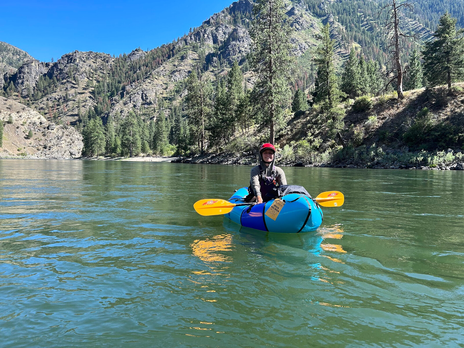
With the hot temps (probably mid to high 90s), it was easy to motivate ourselves to get on the water early. After a chilly spring in Missoula, it was super nice to paddle without dry suits on, and we made great time through the big water. We wanted to hit the big climb out of the Main Salmon canyon early in the morning on day 3, so the decision was made to push all the way to the South Fork Salmon today. Overall the paddling was quite nice, although the 30-person oar groups and backcountry inholdings along the river somewhat diminished the wilderness feel. We were fortunate to not encounter any jetboats though, and enjoyed all of the bird life along the Main! I lost count of the number of bald eagles we saw presiding over pools or flying along the river. We scouted the first few class III-IV rapids, but mostly felt like the ratings were a bit soft on this section, possibly to do with the lower water at this time of year.
some IK’ers we watched run the first III-IV on the Main
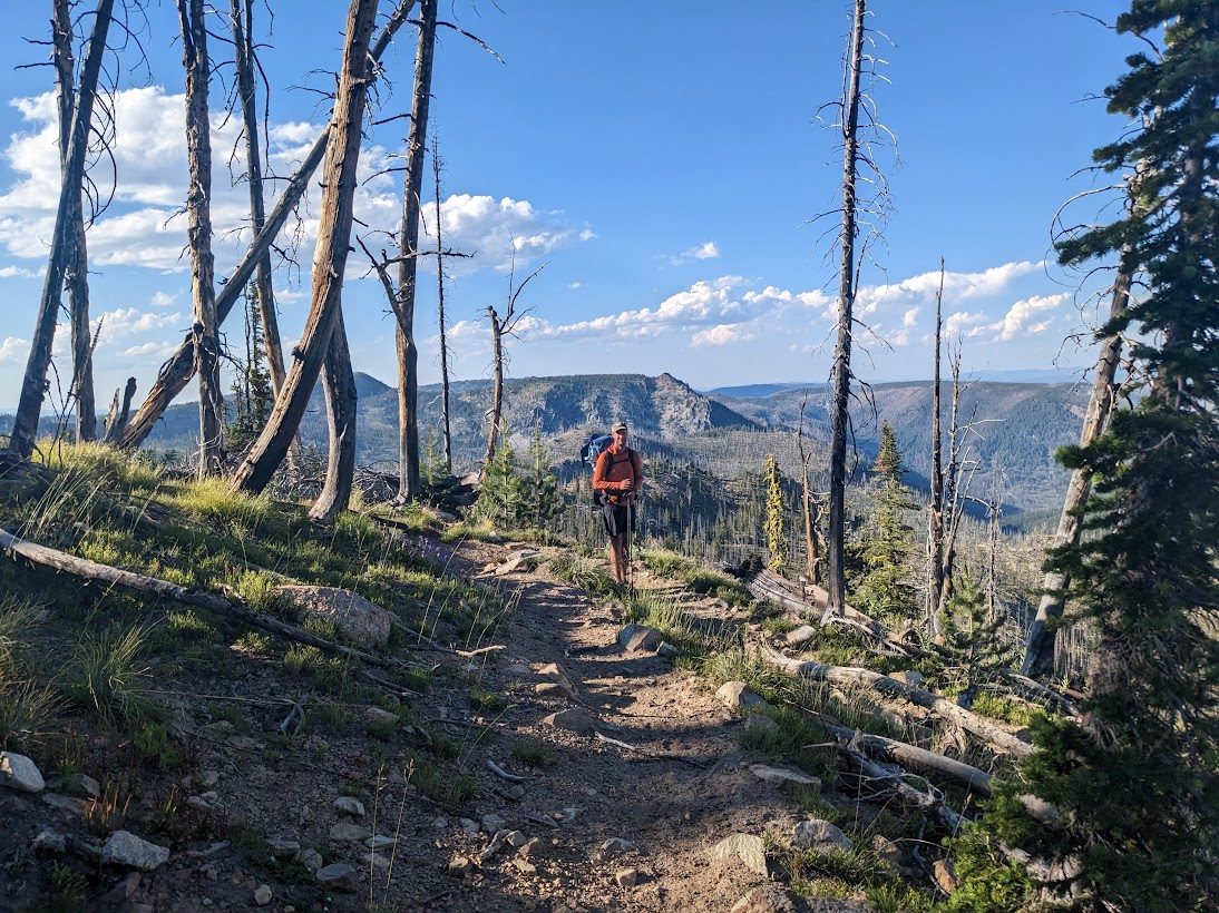
Day 3: Big Climb out of the Main Salmon
Hiking miles: 9
We woke up at 5am on the day of our big climb, already behind because of my faulty alarm wrangling. Navigating to the trail off the Main was a bit tricky with the Mackay Bar private ranch - they do not want people using the easement to access the trail system. If we did this again, we would consider paddling to the sandbar between the Main and the South Fork Salmon and going up the S Fork 200yards to a nice cobble beach back on public land.
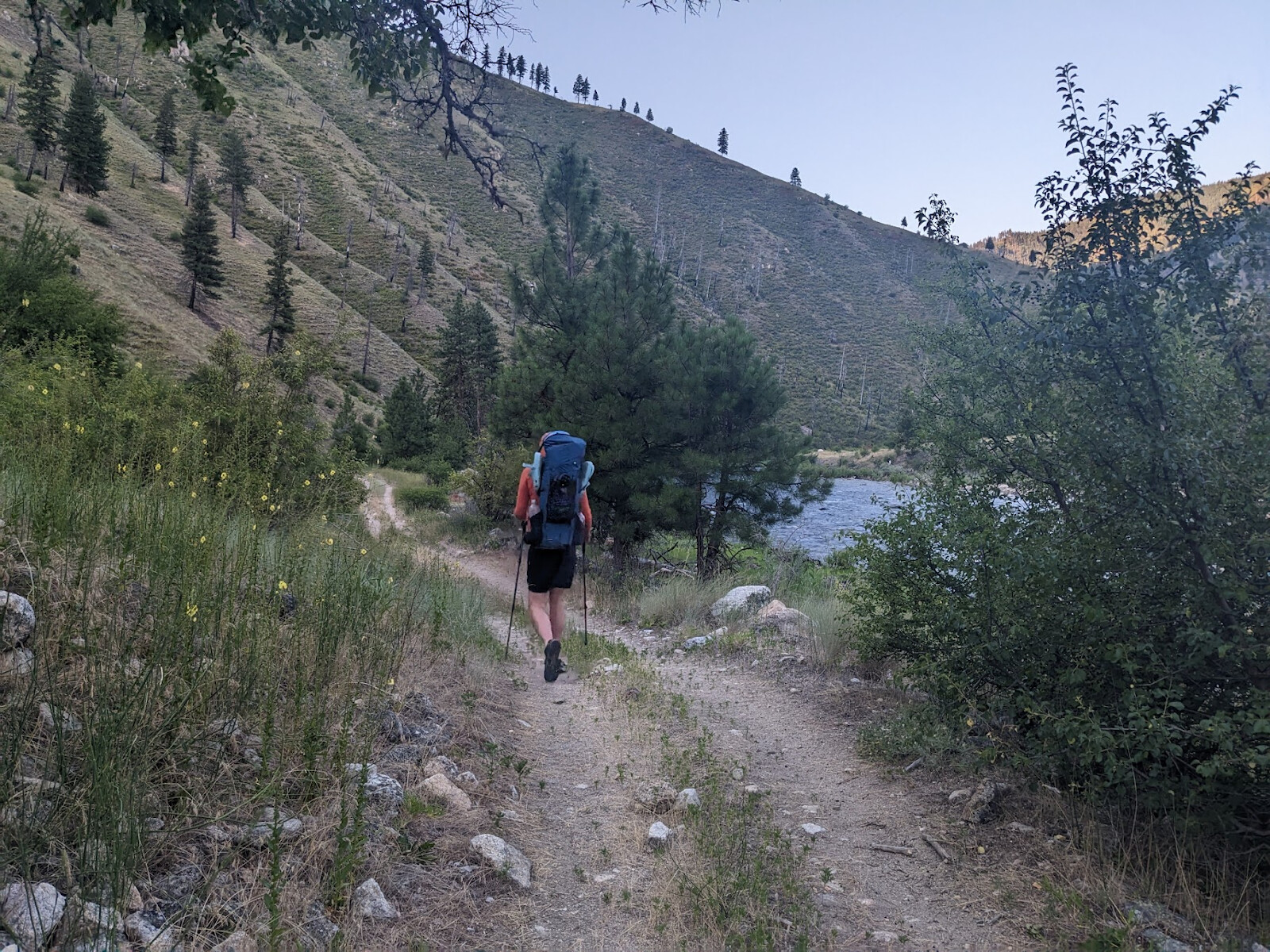
Owen hiking along the S Fork Salmon
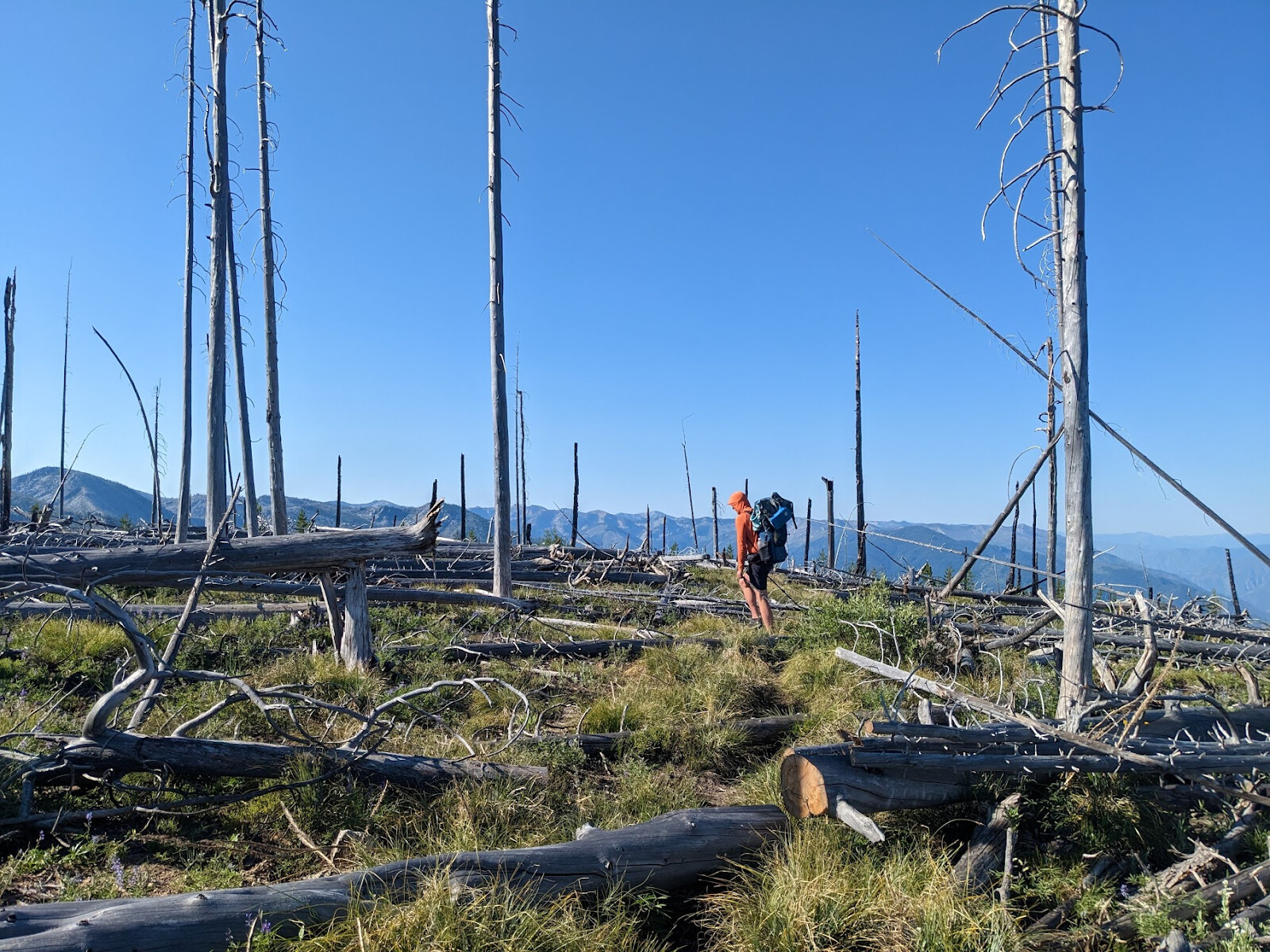
Once away from the river, the trail climbs an uncountable number of switchbacks towards Horse Heaven peak. We made the first few thousand feet in the morning shade on the west-facing ridge, but it was slow going & lots of shade-hopping once the sun hit. One advantage of doing the trip in July was not having to carry dry suits for this portion, but we were pretty worked by the time we topped out, between the ~95 degree heat & the relentless grade up ~6000 feet of climbing. We were happy to find water at Spring Camp, but the whole hillside was a shadeless burn zone and we did have to bushwhack a bit off trail to get to the spring itself.

sweaty and smiling
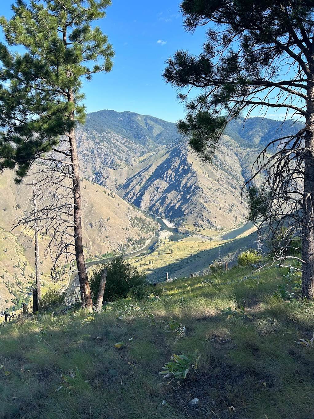
view back to the S Fork / Main Salmon confluence
The going didn’t get much easier as we traversed Horse Heaven peak, with a ton of balance-beam log piles. There’s a break in the burn near Quartz Spring, where we were pleasantly surprised to be back into green trees and shade. Quartz Spring itself is a blissfully frigid pool with a clever log spout built in, and an excessively well-graded campsite to match. We took advantage of the awesome camping and slept right there!!
Day 4: Along Horse Heaven / Mosquito Ridges
Hiking miles: 13
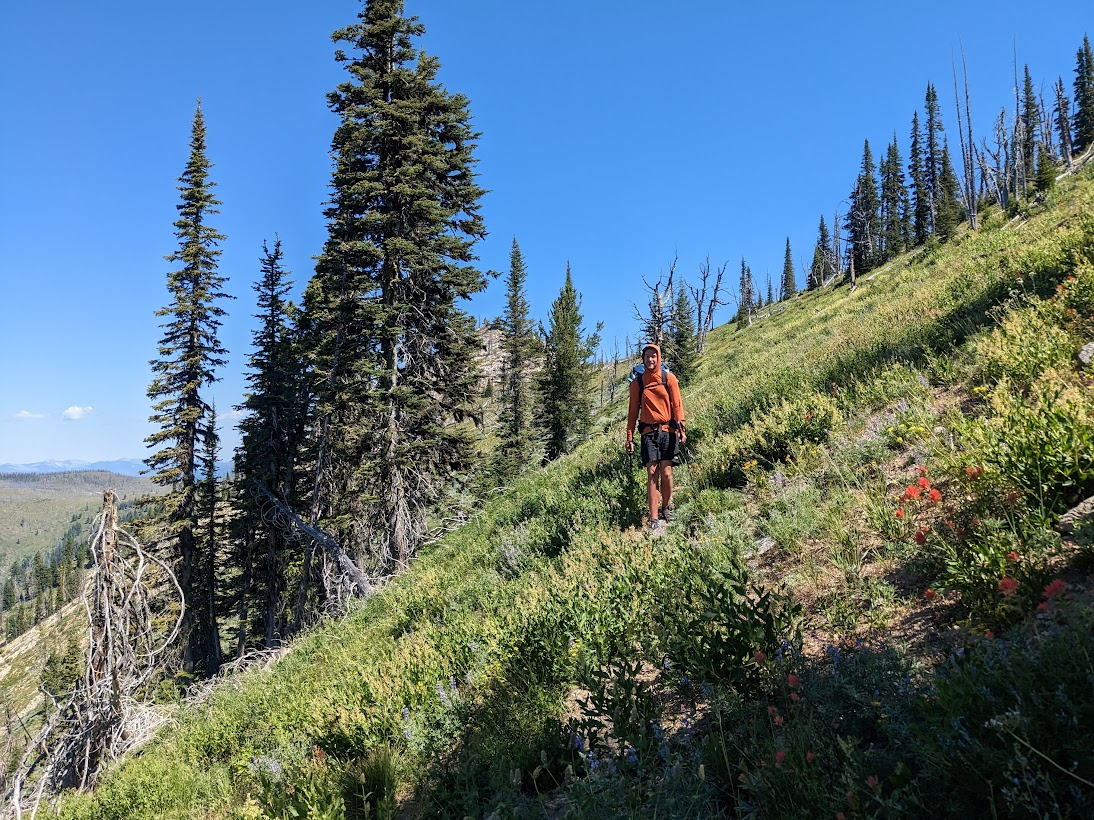
Past Quartz Spring, the trail goes back into the burn, and we were very glad we hadn’t pushed on to Soldier Spring as we couldn’t spot a discernable flow of water there. The ridge was a riot of wildflowers, and despite the cloudless sky, walking mostly on the ridgetops meant that we had a good breeze. The trail did quite a bit of PUD thru here to keep the good views rolling, including some peeks down to the South Fork Salmon and deeper into the Frank Church to the east. We were both tired from the heat the previous day, and continued our hot-weather tradition of hiking early & taking a mid-afternoon siesta to escape the hottest time of day.
There was a ton of water still in this section, including below the Chicken Peak lookout tower and at Mosquito Spring. We ended up camping at the Mosquito Ridge trailhead, which featured a lovely brook coming down from the saddle and, as could be expected, a ton of mosquitos. That night was probably the most bug pressure we had the whole trip, but we were only slamming dinner and passing out so it wasn’t such a big deal.
Day 5: Big Creek
Hiking Miles: 8
Paddling miles: 8
On the map, there are some “more direct” options to roadwalk down from the Mosquito Ridge trailhead, and there are some well-graded switchbacks. The “more direct” options are all pretty much overgrown and unwalkable, we learned, so that added a good amount of distance to our planned morning. We were happy to encounter an ATVer who lives in the little community upstream from the Big Creek trailhead - Chuck is a long-time resident and whitewater kayaker whom we grilled about the conditions on the creek. For a long time, Big Creek had a mandatory portage log jam, and he confirmed that was gone, as well as giving us some good beta about accessing the creek from the trail.
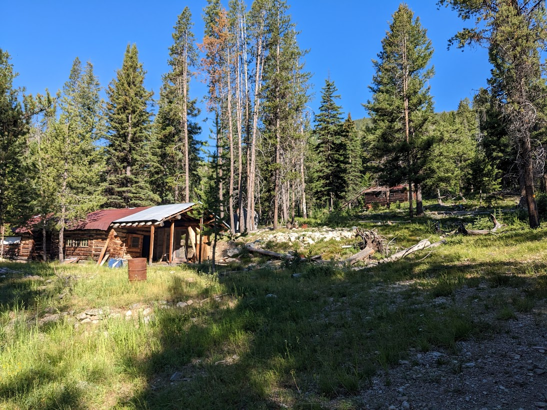
abandoned mining buildings along the road down from Mosquito Ridge TH
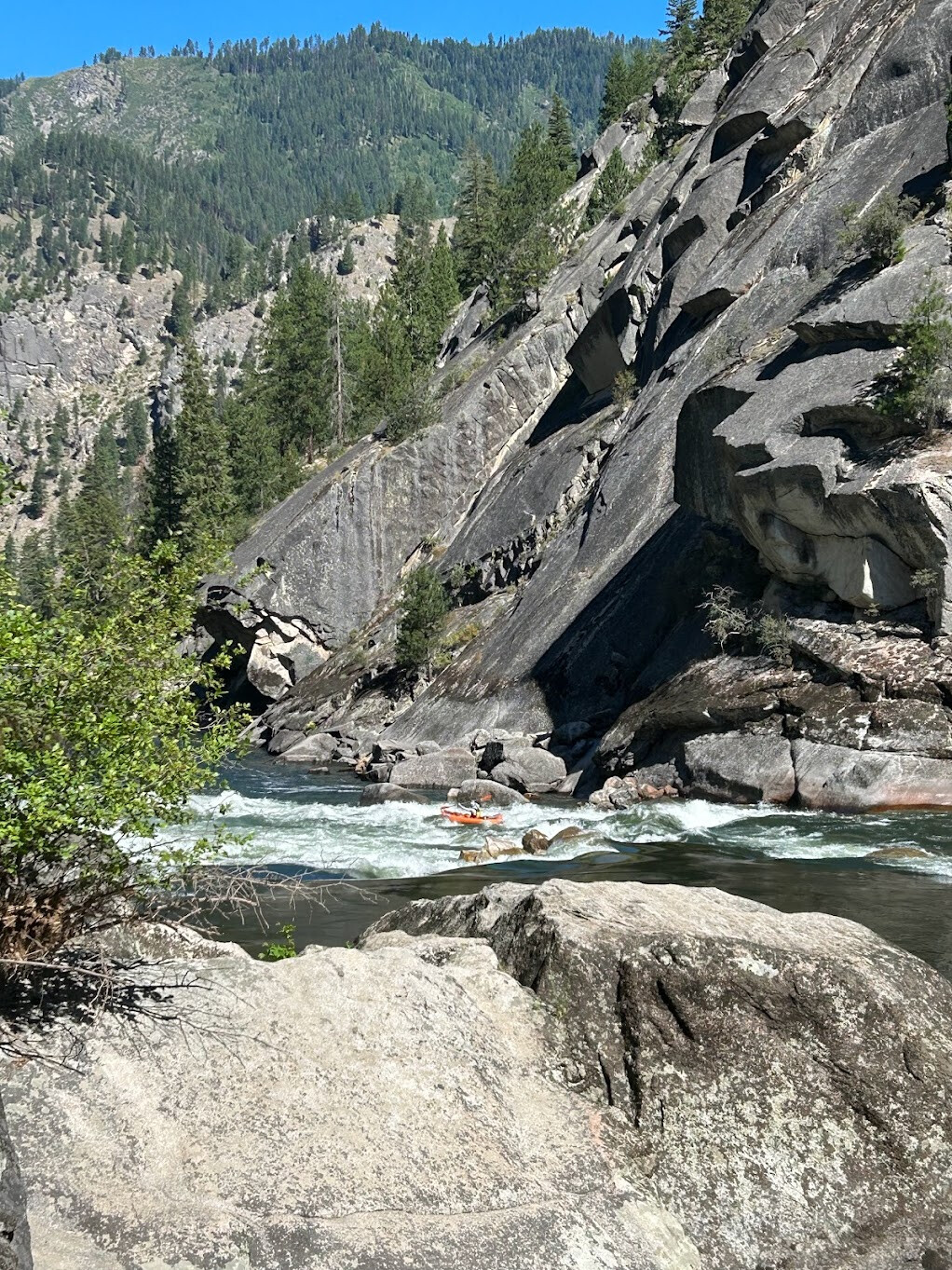
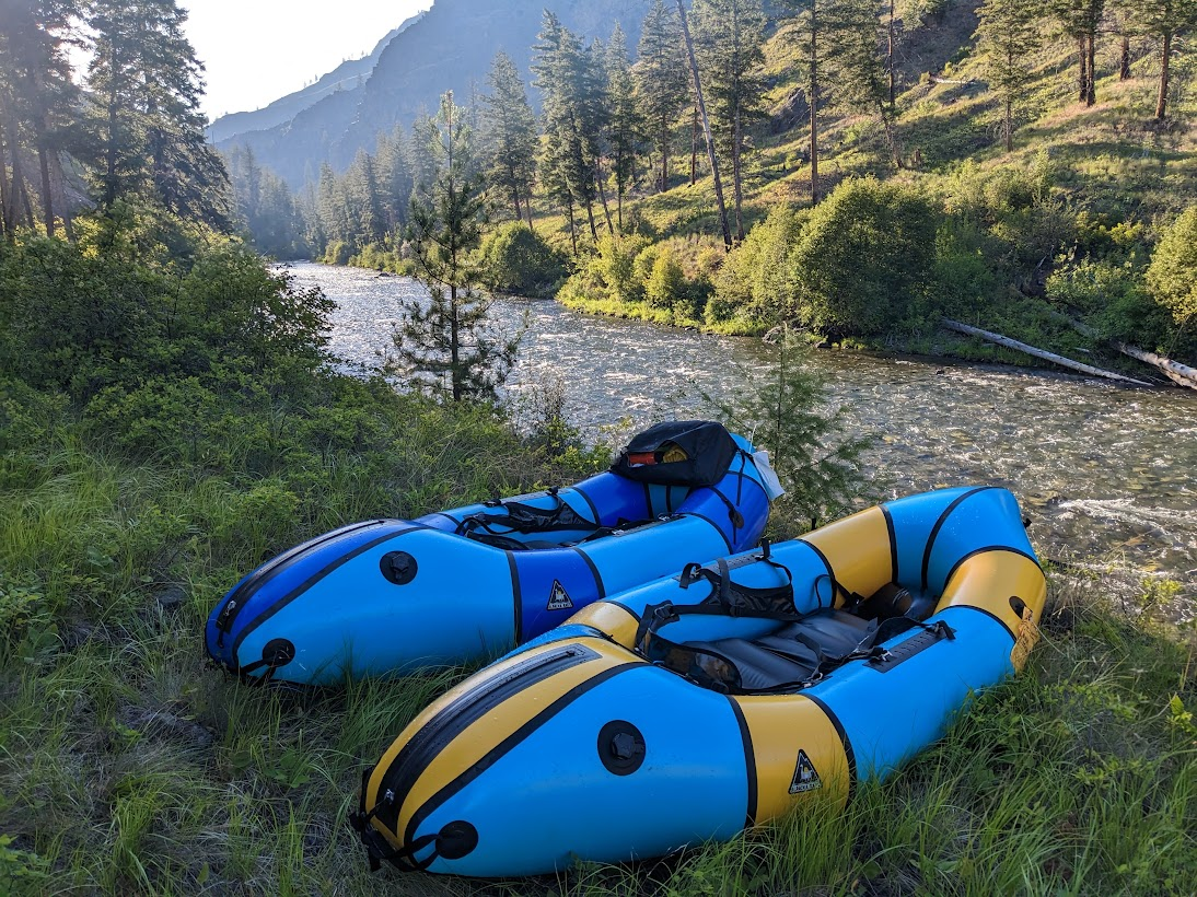
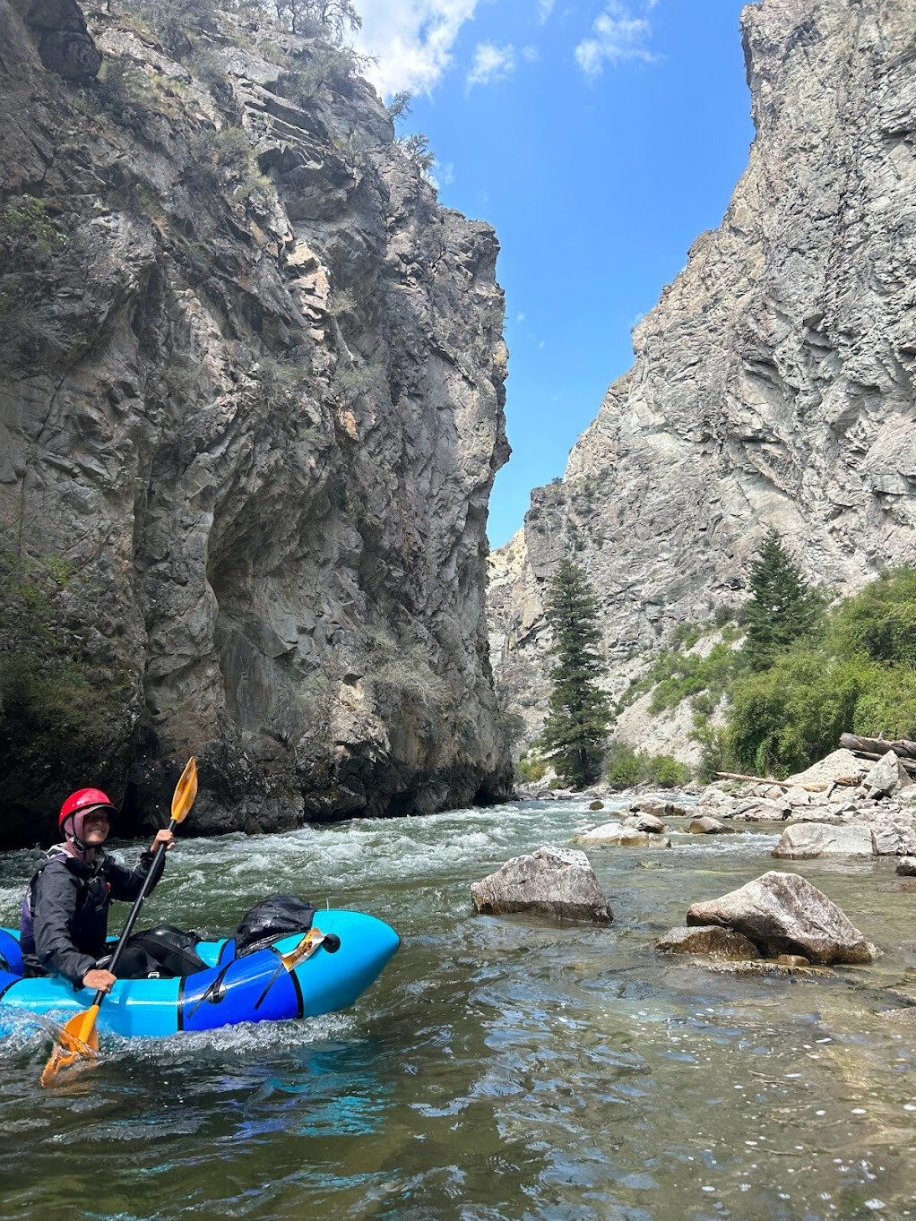
With Chuck’s advice on board, we pushed a mile or so down the Big Creek trail to where the trail actually meets the water, instead of trying to scramble down a steep embankment to the water at the first possible opportunity. After a few days of hiking in the heat, it was great to float along & be cooled by the creek. With the late season, the paddling was pretty heads-up, not so much for logs altho there were a few of those to navigate, but mostly so that we didn’t get grounded on the gravel bars. There was one navigable channel available on any given stretch of river, so we had to be pretty alert to keep moving.
clear water & pretty drops on Big Creek
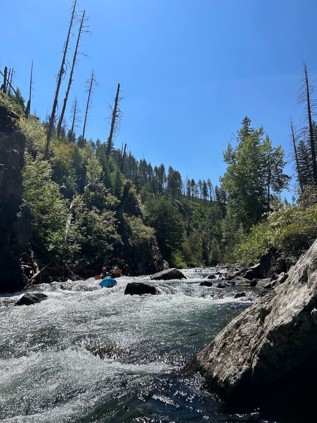
The creek mostly wound its way along the river bottom, with only two constrictions / rapids that we encountered on the first day. The first rapid is near the Chamberlain trail junction, and was a super fun set of 3-4ft drops into big pools, with plenty of boulders to eddy out around, even for two packrafts in the tiny creek. After that, there are a few miles of mellow and beautiful paddling past places named Over Easy Bar and Hard Boiled Bar. The final rapid of the upper stretch comes just past the Egg Bar section, and was certainly the stiffest of the trip at these water levels. I swam below the first drop and nearly pinned my boat against the huge boulder near the bottom. We camped not long after that on an unnamed bench river left, happy to have quite a bit of paddling before hitting any whitewater the next day!
Day 6: Big Creek, Middle Fork, and OUT!
Paddling miles: ~45
Driving miles: 164
Our second day on Big Creek was also magical, including several miles with the highest density of kingfishers I’ve ever seen. We had encountered one group of backpackers fishing the day before, and didn’t see anyone else along the creek until we were passing Taylor Ranch. The pace mostly picked up after the Monumental Creek confluence, but I still found myself cheering every little streamlet that came cascading in along the way - “That’s 5cfs right there!!” I’d shout over to Owen.
Paddling through a wide valley on Big Creek
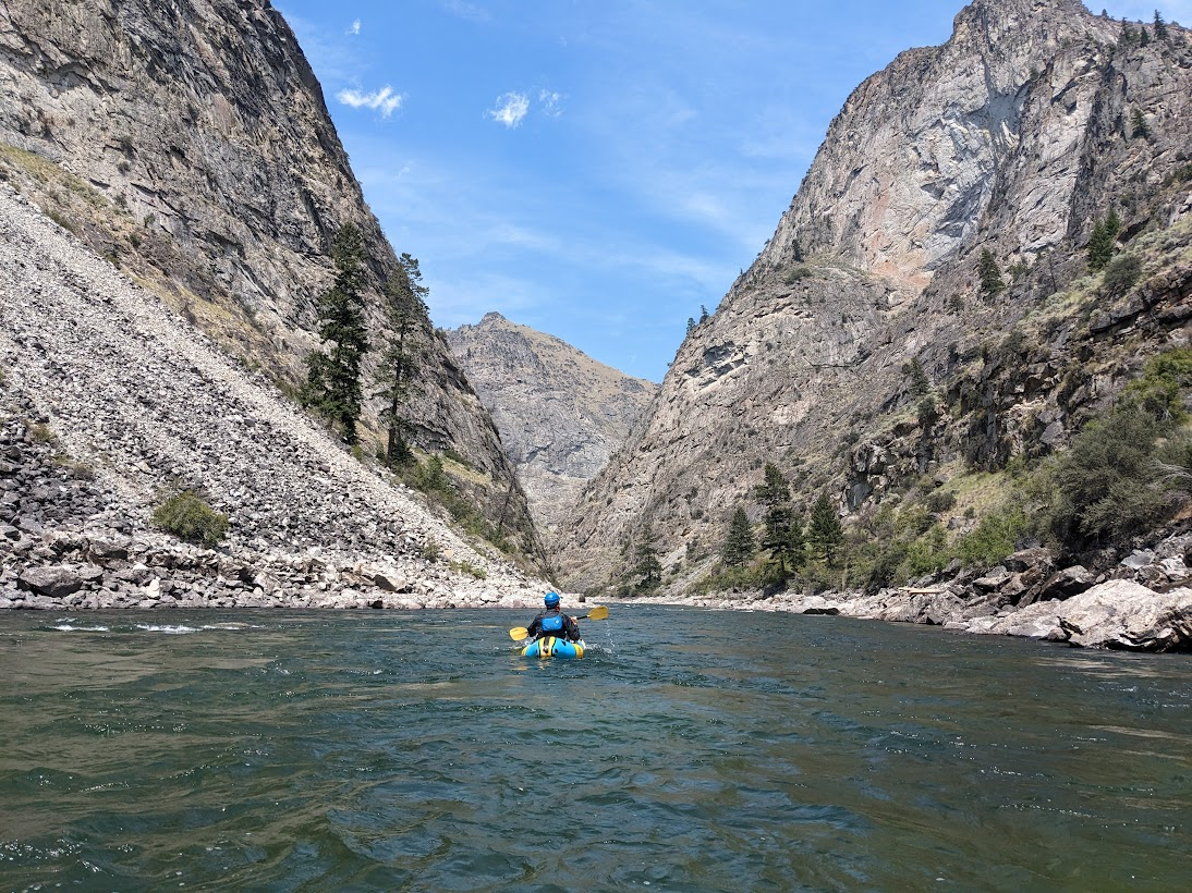
The final ~3 miles of Big Creek are in a granite gorge commonly hiked by river groups wanting colder water for fishing or swimming or even as a side-bag kayak mission, and we did start to see day hikers as we entered this final stretch. There isn’t much camping along here and the gradient picks up again, so we knew that once we committed to the section we were going to finish out the ~21 miles on the Middle Fork as mandated by our tributary permit. We shot through the immensely fun chutes and drops of this lower stretch quickly, and popped out of our wilderness experience right into two ~20 person river groups on the Middle Fork of the Salmon.
happy paddler on the lower Big Creek gorge
It was a bit shocking to go from the colder water & solitude to the warm & busy Middle Fork, but we made the most of it and even were gifted some bubbly waters to go with our lunch. The canyon along the Middle Fork is absolutely stunning, and we felt very fortunate to be able to experience such a coveted stretch of river with just our two little boats. There was a ton of wildlife in this section also - numerous bighorn sheep families and an uncountable number of baby quail, all cooling off in the heat down near the water. We marveled at the high waterfalls cascading down granite cliffs above us and splashed through the beautiful clear water at each drop. Again, we felt that the ratings were a bit soft, but it may have had to do with the water levels.
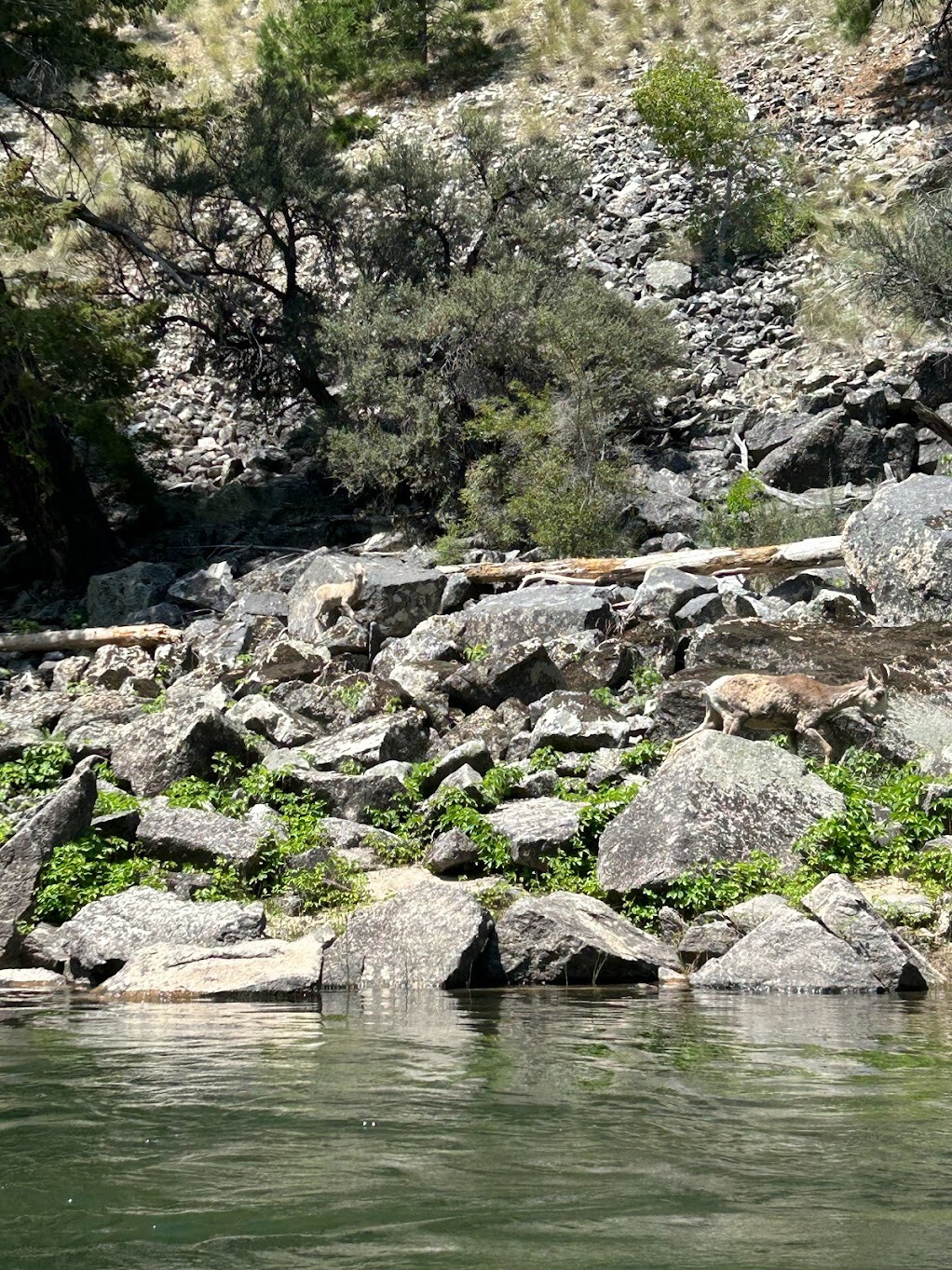
baby bighorn sheep!
The one rapid we did pop out to look was Cramer, right after the Main/Middle Fork confluence. Duwain Whitis claims this is “close to Grand Canyon 8” which we didn’t quite buy - it was certainly worth the scout, but had a nice green seam down the center right side that didn’t get us too wet. At this point of the day, we did have a very warm upriver wind blowing on us, and the last ~5 miles, mostly big river flatwater, along the road back to the Corn Creek ranger station, felt like a slog. We were happy to return to the boat ramp and to shove pizza in our faces on the ride back to Missoula after a successful completion of the River of Return!!
Owen on the Middle Fork Salmon