Little Su is super fun right now, so fun I ran it three times in the last week.
The best place to put in when it’s this low (3.3 feet) is at 11 Mile Fishhook Road. Leave a bike at the Fishhook Bridge (about 8.5 mile), then drive up and park at the Government Peak Picnic Area. Walk up the road 50 yards and put in. Upstream is too bony and flat for my tastes at these super low flows.
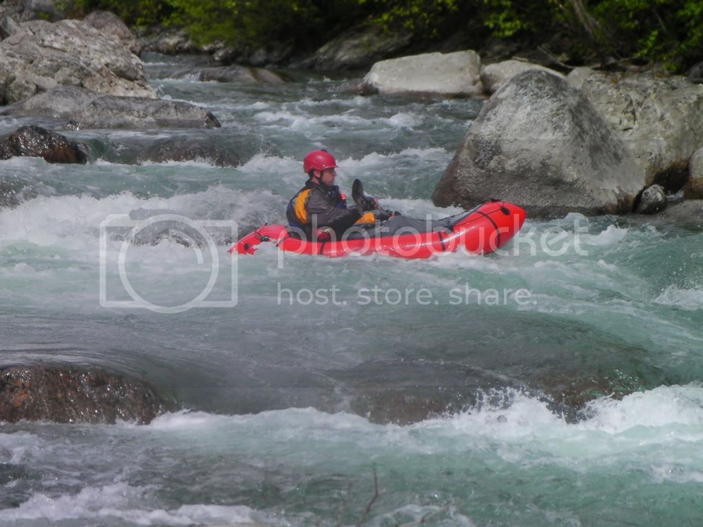
Not much of a warm-up but super fun. A swim can be bruising and don’t try to stand up if you swim as the rounded granite boulders could grab your foot like a lock.
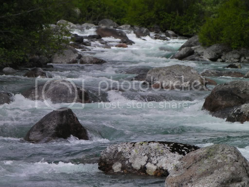
There are about eight or ten wild drops and lots of boulder gardens.
As you drive up the road you can see the creek here and there. Early on (upstream of the bridge at the third time the river comes in view, starting with the bridge view) is a log under water jammed on river left bank and a midstream boulder. Also visible from the road at about nine point something (maybe the fourth view?) is a long stretch alongside the road. You’ll see a big triangular boulder midstream and it’s undercut. We met a couple other butt-boaters and they got a boat stuck under it. Upstream and still in view (there’s a pull-out) is a flat topped rock with an undercut also. Worth looking at these as you drive up by getting out and scouting form the road.
Between 10 mile and these roadside views are several steep rocky drops that can be boat scouted.
Anyway this is a classic packrafting creek, worth multiple runs in a day.
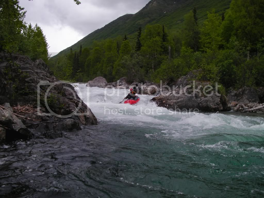
Roman may call the stuff up above Mile 11 ‘too flat’ but on August 1 it was just right for 4 of us who put in at the upper end of the Gold Cord trail parking lot. Plenty of swift drops and slots. Abundant small to micro sized eddies. Scouted one drop and turns out it was not the one where 3 of the 4 of us swam. I would never be able to find that deep, grabby hole again and if I did, by going river left of the lead-in rock we would have missed the swimming fun by dropping over a small pour over.
To put our boating prep in perspective for running this: we ran Baby Su down stream of the bridge a day or 2 before and had run the upper and middle sections of South Fork Eagle River in the previous week.
Roman’s video of Mile 11 to the road bridge looks head and shoulders more committing than the Gold Cord to Mile 11 section. Way to go, Roman!
Little Su is great right now. Gauge said 460. I was solo so I skipped the real fun section. Put in at Gold Mint and took out at Gov. Peak site. I like this upper part a lot more then when I ran it last year at 350, same amount of boulder dodging and less butt scraping.
Water was a little higher then Tuesday. Mark Oathout and I put in at Gov. Peak/11 mile. The higher water level seems more fun to me with the cleaner lines.
Little Su today was the exact same level as Roman’s “Liztomania” video, 275 cfs.
I didn’t like it as much as at 460, but it is still a great run. Should be a perfect level for a 4th of July descent.
I recommend skipping the upper section and even snake pit. Putting in at Gov. Peak and running to the bridge will help you skip a lot of butt scraping.
Ran Lil Su today. Gauge was 540 cfs at 1230. I went from the Motherlode to Gov campground. Wanted to run from Gov to the bridge but thought I would have been pushing my luck so I stuck to the upper section. Never felt too overwhelmed tho I did go for a brief swim. The new rafts allow to run at higher water IMHO. I feel like I would have been toast in some of the rapids/holes/hydraulics in my old boat.
One alternative put in i like is at the ski hill parking lot mp 12 where fishhook creek pours into the su. It avoids the boniest upper section but lets you hit the nice drops between there and the campground
You can go a ways below the campground to mp 10 andntake out near a fallen tree on the right. It will allow you to avoid the more serious stuff between mp 10 and mp9 (landslide area)Another decent place to put in is just above the landslide by the parking area and go from there to the bridge. Seventy meters past the bridgenthere is a nasty littlempiece of iron stickimg out of a midstream boulder it covers at 500 cfm and will ruin your boat and your body. Its right at the top of the rapids below the bridge. Someone should cut this off with a hacksaw once winter comes. There has been way too much water in there the last few weeks seems like its been700-1000 most of august. A couple timesmive seen grebes and ducks living and traveling on the su. They seemed to be unfazed by class iv + water but then agAin they are the new and redesigned 2011 grebes.
Looked at Little Su 9/10/11. It was running at 175 below the bridge, and 6.3 above. I’m not an expert by any means, but we decided it was too low to run at those levels, just FYI.
Little Su is still doable and very scenic at 120 cfs in the lower section. Put in 150m below the mp 10 sign. probably want to portage the death ferry. Take out shortly after you come to the pool next to the rock wall on the left. there is also enough water below mp9 until you get to the bridge falls which are mores stone than water. fairly short run and probably not worth a drive from anchorage, but worthwhile if you live out here or are out for something else. Above mp 10 the water is too spread out and you will be dragging way too much.