Upper Eagle River
I mean really upper eagle river…
Any takers?
Tempted… but flying solo I stayed out of it… Looked like fun! powerfull fun.
Upper Eagle River
I mean really upper eagle river…
Any takers?
Tempted… but flying solo I stayed out of it… Looked like fun! powerfull fun.
I think a sweet trip would be to run from crow pass over to ER drop in float to EB the run to ERNC. Afterwards go to PM for PMS.
By the way that last 2 are PM -Pizza Man & PMS is of course - Pizza Man Special.
And a cool fall day in September with all the colors would just add more to this kicker.
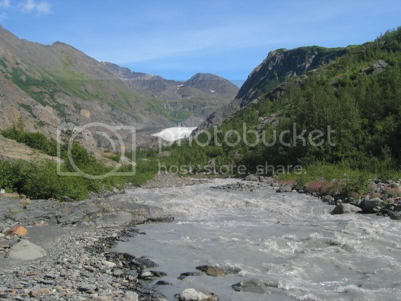
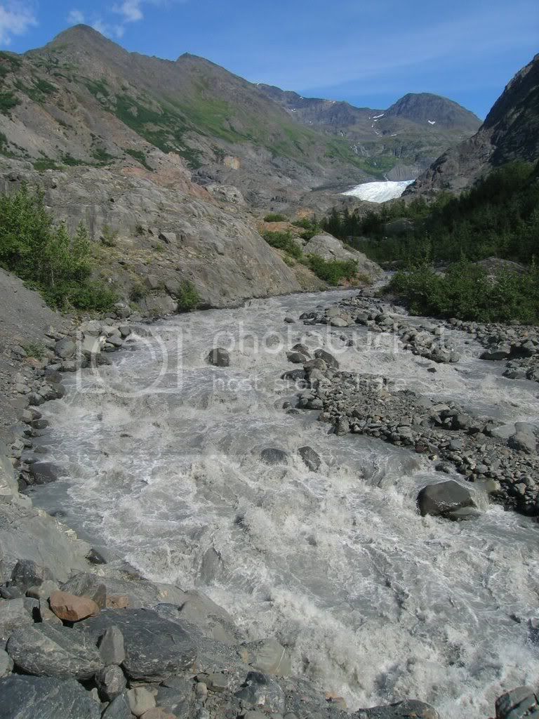
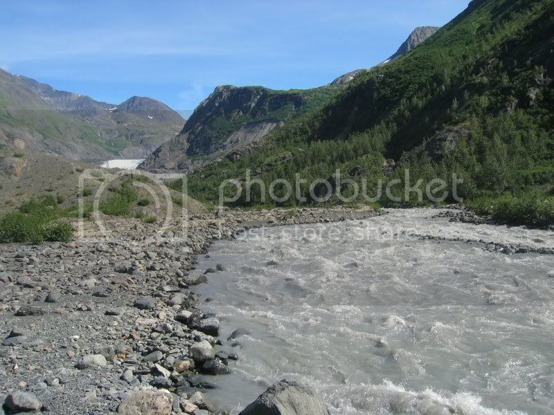
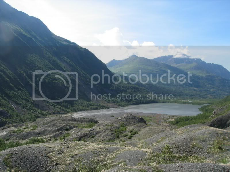
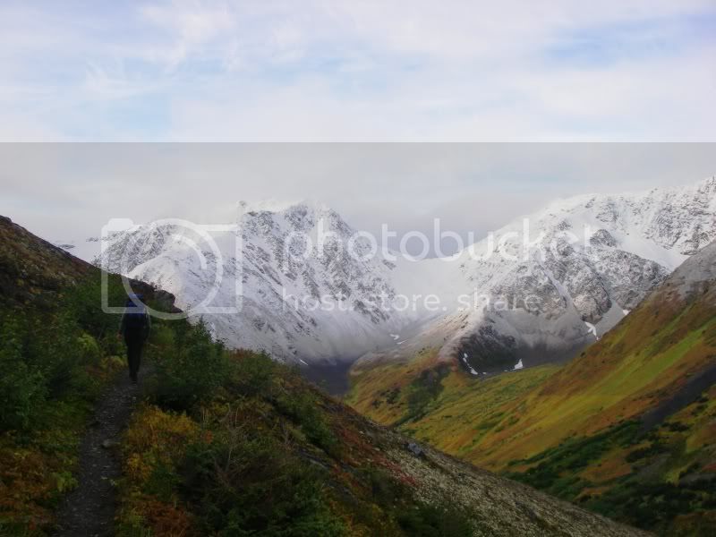
Almost as much of a classic as the Twentymile, Crow Pass is a great packraft trip except for the shuttle. If you can figure out some way to get dropped off at the Crow Pass trailhead, this really is a great trip. It is more of a pack than a raft, however, as you walk about 14 miles before putting on the Eagle River for about a 9 mile float to Echo Bend. The boating is generally Class II through this section, with several swift sections in the first few miles below the put-in and then numerous sweepers to dodge and portage around. Dealing with the sweepers gets to be a drag after a while.
At Echo Bend the river drops dramatically through a section of Class IV/V water that should be avoided by most folks. There is a scouting trail that runs along the north bank so you can see just how bad it gets. From the Echo Bend take-out hike another mile downstream and put back on at Rapids Camp for a short section of Class III followed by two miles of Class I/II to the take out along the Albert Loop Trail. Take the right hand channels after the River Trail Yurt, and watch for orange flagging marking the last point where the Albert Loop Trail is near the river. From this take-out to the Eagle River Nature Center is approximately 0.5 miles. Alternately, if you don’t feel like reinflating your boat after Echo Bend, walk the remaining mile to the nature center.
It looks to me that Raven Creek could be runnable from a point below the Raven Gorge to the confluence with Camp Creek, but it looks like it drops pretty steeply after the confluence with Camp Creek. I would be interested in seeing posts if you’ve got any experience with Raven Creek.
ERWEB.jpg
October 16, 2006
Roman Dial, Este Parker and I ran the Eagle River from Echo Bend to the Albert Loop Trail on October 20, 2006. The river is currently quite low (guaged at 3.4 ft; see the hyrdograph at: http://aprfc.arh.noaa.gov/ahps2/hydrograph.php?wfo=pafc&gage=erba2&group=255743&view=1,1,1,1,1,1)
At Echo Bend the Eagle River transitions very quickly from a meandering river to a steeply dropping one as it cuts through a glacial moraine. For the first mile below Echo Bend the river is full of boulders of various sizes and the forward visibility is limited. At the 3-4 ft flow level the river is surprisingly slow, with lots of opportunities to back paddle and stop in eddies. The drops are sharp but you can maneuver and manage the pace.
The most abrupt drops occur in the first half mile, warranting a Class IV rating, and thereafter the gradient begins to lessen. By Rapids Camp, approximately 1.5 miles below the put-in, the river is Class III and eases to Class II shortly thereafter. Take out is either at Rapids Camp or further downriver at the Albert Loop Trail. We left the Nature Center at 3:30 pm and were back at the car before 7 pm.
It advisable to check the river gauge before running this segment of Eagle River. Higher flows will make the first 1.5 miles far faster and more dangerous than we experienced. There is very little wood in the river at present, but that situation can change at any time. A scouting trail runs on the river right bank for most of the segment between Rapids Camp and Echo Bend, and you are advised to scout the river before running it.
Brad Meiklejohn
Eagle RiverWeb.jpg
A year later, the 3.4 foot level again proves to be ideal for Echo Bend.
Web.jpg
A nice evening diversion is to run the Eagle River from Campground Rapid down to the Bravo Bridge on Fort Richardson. We did it recently by stashing bikes at the Bravo Bridge and riding out the dirt roads that eventually bring you to Artillery Road in Eagle River. The float is about 5 miles of Class III with some fairly large holes that are easily avoided. At guaged levels above 5’ it can feel a bit intimidating being on this section of the Eagle River in a packraft, but it is good practice if you want to see how the boats do in bigger water. From Bravo Bridge it is about an 8 mile bike ride back to the put-in. Recreation permits are required to enter Fort Richardson, and these can be secured at the Fort Richardson entry post. An alternate method for the shuttle would involve strapping your bike to your boat, but you’ll have to ask Roman how to best to secure your bike to your packraft.
On August 19th we floated from Icicle Creek to Echo Bend. We had to portage around a river width sweeper just downstream from the Perch (on river left) and closer to Echo Bend we portaged around a large collection of snags also on river left. We passed 2 other packrafters on the trail who had taken out just upstream of Icicle due to a log jam.
Raven Creek has a 10 to 20 foot waterfall at the lower end. Dick Griffith
Hey,
Did you get a look at the whitewater up above the pictures of the big water class III/IV photos you posted at the top of the thread? If it enters any narrow slot canyons w/ waterfalls I’d be interested in hiking back there w/ the kayak this coming summer (we’re already planning a decent of Raven Gorge through the falls, so I guess that Upper Upper eagle river section wouldn’t be too crazy far out of the way.
Timmy J.
kayaker35@hotmail.com
http://www.alaskawhitewater.org
![]() For those who haven’t seen them here are the falls!
For those who haven’t seen them here are the falls!
The recent picture posted of the falls on Raven Creek is on the upper portion of Raven Creek. It is located along the popular Crow Pass Trail/Iditarod Trail. The falls that I mentioned is located down streem from the confluence of Camp and Raven Creeks. The falls is situated between narrow canyon walls and can be reached by skiing one mile up from the confluence of Raven and Eagle rivers.
Local classic indeed!
A friend Charlie and I did Crow Pass → Eagle River yesterday and it was a dern good time.
The weather was great from the get go, with awesome colors to match.
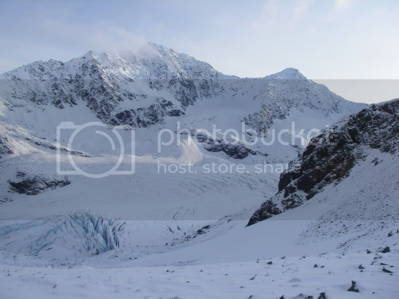
There was maybe 3-4" of new snow at Crow Pass which made for fast travel and great scenery
Which gave out to the standard summer of 2008 muck.
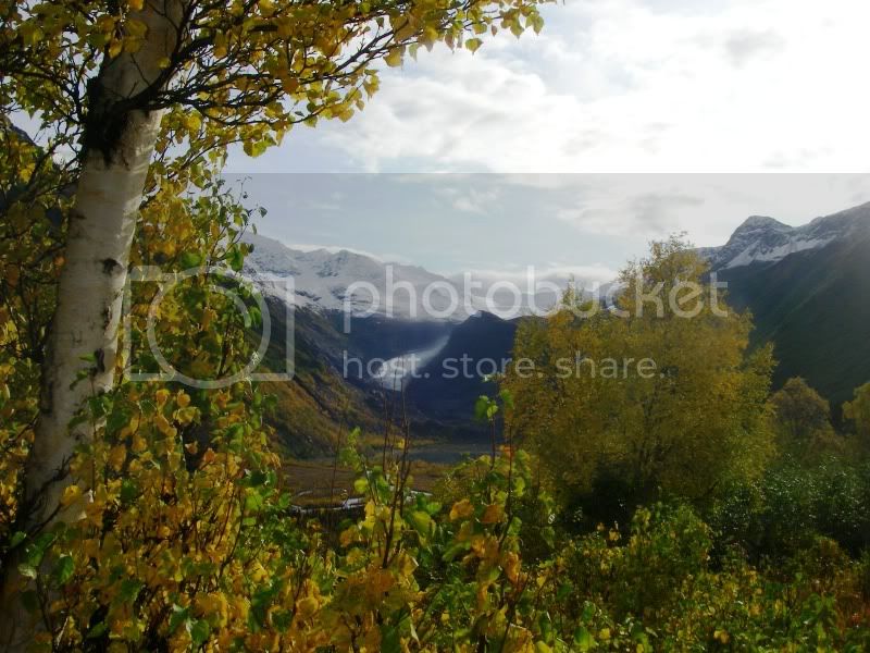
Which gave out to awesome fall views
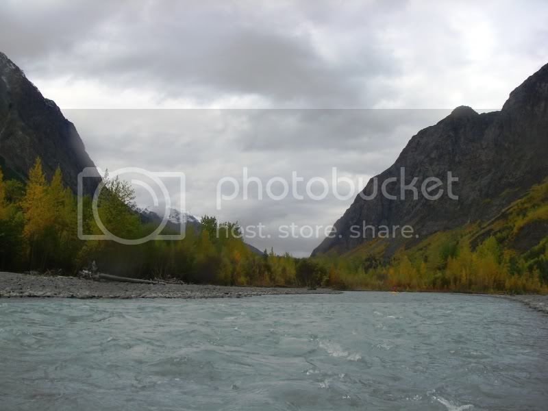
And a fun float out
The water level was a little higher than normal given all the rain the couple previous days. We took out for one low spot and only one very visible sweeper.
Great trip, go get 'er done while the colors are good. 
This was supposed to be a quick post about the current conditions of the Echo Bend rapids along with a cool video of it from a GoPro helmet-cam to replace that made by my old ATC-2K (much wider lens on the GoPro so doesn’t jump as much). Anyway, that’s what this was supposed to be. It didn’t turn out like that.
Today, lunchtime: Rain seemed to be slacking off, saw that the ER gauge said 3.4. Had run the rapids before at that level, was feeling good about my paddling (no expert but can hang with the intermediates), ran the first canyon of six mile at 10ft last week, did some short runs in Kodiak during the weekend. A quick afternoon trip and I’d be back for dinner with the wife. Some quick scouting as I hiked, thought it looked a bit quick, but heck, gauge said 3.4, just my imagination. Got to Echo Bend, seemed like the water was a bit higher than I remembered for suitability for this. Oh well, river probably just shifted channels or something. Found out I had left an all-important attaching clip for the GoPro behind so no video this time. Got in the raft and started on my way.
Hit the ground running. Now I knew for certain this was not the same 3.4 as before. Minute or two of exhilarating thrashing followed by a “relaxing” swim. Made my way to shore, somehow with the paddle. Raft behind me but still in the current, uh-oh, maybe I should have marked my name and # on my newest one beforehand cause it didn’t look like it was gonna stop. Somehow, it finds itself against a rock in the middle, precariously balancing. Goes left and I don’t see it again. Goes right and I might be able to grab it. Stays there and I don’t know what would happen. Almost on command, it decides to come right to me. Okay, needed to get my groove back, found a place to relaunch. More thrashing and find myself turned around heading backwards slowly into a hole. This results in the predictable dumping with my helmet more than making up for its purchase price by absorbing (to the best it could) a vicious impact with the rocks on the bottom.
Time for some serious reconsideration. On one hand, I came to raft. However, either; I hadn’t brought my A-game, my balance was off, I wasn’t as competent as I thought I was, the river was plain trying to kill me, it just wasn’t my day, I had caught a brief rain-surge, or whatever. I decided to do some more thorough scouting before getting back in, regardless of the hassle. This proved to be a fortuitous decision as next on the list would have been what would have been the logical line going through ever narrowing gaps between rocks until packraft and paddler became the wrong side of a wedgie.
Settled on scouting (or re-scouting) the roughest parts, walked around what I deemed outside my comfort-zone-for-the-day, and ran enough to persevere through the ego-bruising I was taking. Took home some lessons:
-Every river, no matter how familiar, can be completely different on any given day.
-My skills and comfort level can also be completely different on any given day.
-I don’t know enough river science to explain why this 3.4 was different than another day’s 3.4, but I do now know to treat the gauge reading as only one part of the scouting report.
-While packrafting solo has its disadvantages, like not having another person say “this doesn’t look right, let’s call it a day”, there also is no trying to out-macho somebody else when going alone.
-Recognizing its just not my day and taking it down a notch is ok.
So anyway, for the technicals for those interested. Echo Bend to Rapids Camp is clear of any log jams, sweepers, etc. Rapids Camp to a point roughly perpendicular to the Nature Center has a few obstacles, but nothing requiring portaging. The Albert Loop trail for the hike back is fairly muddy but not horrible.
One of two possibilities. The first being time of day. Generally morning is low/evening is high. However, this effect will depend on proximity to headwaters area, melting snow/run off source, etc. Typically early season or when there is a lot of snow still in the mountains, the diurnal will be larger depending on daily temperatures. Was it significantly warmer on the day in question? With that I’d bet that the water that you found in the river had yet to register at the gauge given it is 20 some odd miles downstream and obviously had not made it down there yet. Was there an increase in the discharge later that evening or the next morning when you looked at the gauge reading again? The second possibility is that the gauge is no longer accurate. This happens all the time as river beds are always changing, although in most cases at a very slow pace. Unless the river/creek flows through a concrete channel it is next to impossible to determine an accurate discharge. Mostly it’s a ballpark figure. Particularly if you ask a group of paddlers. If you’ve got five people, you’ll likely get five different answers. Even for experienced individuals it’s difficult to guesstimate flows unless you are very familiar with a particular run. Alaska’s rivers often make it even more difficult given glacial silt and the fact it is often impossible to see the bottom and thus difficult to determine the x-sectional area of the stream bed.
A group of us just did the Crow Pass trailhead to Eagle River Nature Center packraft yesterday. It was incredibly beautiful and a lot of fun. We were all new to this trip. We put in where the Crow pass trail meets the river for the first time (below the ford). The first quarter to half mile of rapids at the put in was pretty big for us beginners. I would say definitely a PR3 plus (maybe Class III), with a lot of rock dodging and some fairly big holes. Then it mellowed mostly to PR2 for the rest of the trip. I’m not sure of my rating skills however.
What I can say for sure is that the river was fairly boney till around Icicle creek and there were plenty of river-wide and near river-wide sweepers to portage around. We probably had to portage 6-8 times. There was a lot of route finding to do through the braided sections, but it was fun. We ended up missing the proper Echo bend campsite and pulled out right before the drop into Echo bend. In twilight conditions, I could see someone accidentally dropping in, as the drop is actually on a sharpish left hand bend on the river. You can see the drop though, and considerable whitewater spitting up. We found the old Iditarod Trail along the river’s north bank right away. I think it supposedly goes all the way to the Albert Loop Trail and then to the Nature Center. It didn’t look too maintained though, so we elected to go back upstream to look for the Echo bend campsite. We thrashed around for maybe an hour before we found the campsite and hence the Crow pass trail. The sign for the Echo bend campsite is really small and not right on the river, and it being late, it was even more difficult to see. Then three miles back to the Nature Center. I would say an ok way of knowing that you are getting close to Echo bend rapids is that there were a couple of sets of rapids that were bigger than anything else we had come across for quite a while right before the drop.
Ryan