River height: 0.85m at Hillview
Some of you Sydneysiders may recall that Easter 2014 provided ideal paddling conditions for the Shoalhaven river. It also provided some of us with the equal pleasure of playing Easter bunny for our kids. Never mind there is always the Anzac Day long weekend.
Myself, Scott, Dave and James originally planned to do the now classic Great Horseshoe Bend to Badgerys trip, a rare treat as Scott has limited play time (and a car) whilst the other two don’t drive. But we watched as the Hillview gauge dropped down from excellent to a low but just acceptable height. Nonetheless I found an old walk description tracing a circuit from Longs Point over three days which seemed to incorporate a fair deal of river travel as a potential plan B if the water dropped any further. It didn’t but after a chat at the worlds coldest truck stop near Marulan we decided that Plan A could be done in a weekend and would be better with a bit more water. Plan B it was
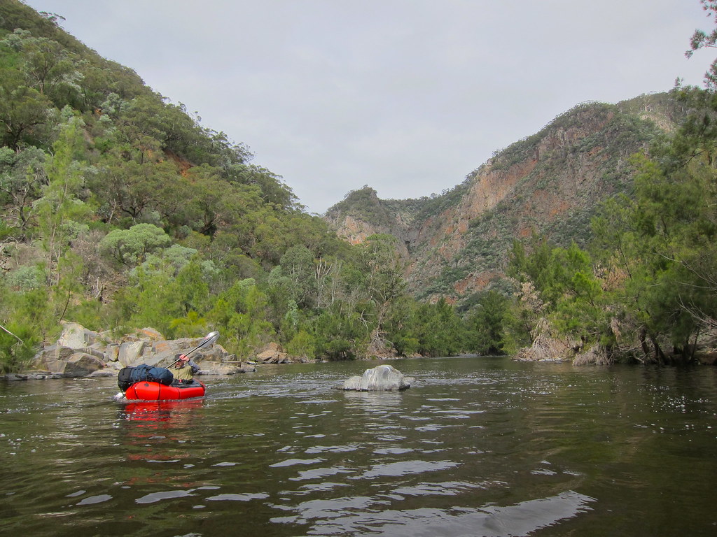
It’s only about an hour or so from the carpark at Longs Point to the Shoalhaven river on a very well graded track but my thighs were jelly and I was doubting my fitness by the time I got there (thankfully the others also confessed to similar thoughts of inadequacy), given our usual faffing around it was lunchtime, so after a quick snack we blew up the boats and jumped in. We weren’t expecting much in the way of white water but there was a very nice grade 2 straight at the put in, a little scratchy to start at these heights but a nice bouncy finish. From there its about 12km of river to our intended campsite at Canoe Flat, a very scenic stretch with numerous small races and rapids up to easy grade 2, a lot more fun than we were expecting. We passed a couple of fellas with Feathercraft pack rafts who’d come down from GBH lunching on a perfect sandbar, note to self as a future stellar campsite. We had a quick chat before pushing on. Canoe Flat is a pretty nice spot as well and it was a relaxed evening and too relaxed morning as it turned out, but this crew has a long history of slow starts and we weren’t about to change now.
When we finally got away on day two we headed up Tallowal Creek for about 1km before heading straight up the steep but pretty open spur to Dynamite Pass. We could hear a wild dog as we headed up the creek that suddenly burst out right in font of us, checking us out before scurrying off, a beautiful big golden beast. Anyone who has walked in the Shoalhaven- Ettrema area knows there are big hills in there and this was no exception. Once up on the plateau the track notes called for some compass work through forest heading south before hitting a 4wd drive track which could be followed for a few kms west to an old hut before again going bush SW to another spur leading back to the Shoalhaven. That was the plan and all went well to the 4wd track which we blissfully followed until we decided to do a GPS check. The road wasn’t where the map said it was, we kept going for awhile to see if the road at least followed the same angles as the map, nope. Scott was the voice of reason and suggested we just take a bearing and head bush. I was the voice of the soft option and suggested we try and find the ‘right’ 4wd track. End result we wasted just enough time looking for the soft option that we guaranteed we wouldn’t get to the river again before dark once we did go bush. To top it off we drank most of our water coming up the hill. About 80 years collective bush sense on display. We ended up finding our descent ridge before settling in for the night on the edge of the plateau. James did a fine impersonation of a Sherpa by pulling out 2 litres of water and three oranges from his pack, life saver.
Not much reason to linger on day three after a decent sleep despite thirst and Scotts nightmares of having his face torn in his sleep by wild dogs, so we headed down our spur, again steep but open, spotting a koala at about eye level (to go with wombats on the plateau for a great wildlife spotting trip) before a late breakfast by the river, which we hit just upstream from Paradise creek. Again the river provided more fun than expected and a float through the spectacular Blockup gorge section, a real highlight, before returning to the start at Longs Point about 12km from where we put in. That left one more hill to get back to the car
I reckon this was a pretty good way to see the area and makes for a nice loop trip. The hills are big but not too bad and the navigation pretty straight forward (if you ignore attempting to find the road!). The trip was still pleasant and very do-able at the height with only one or two scrappy bits but 15cm or so more would have been ideal
Anyway here’s a few pics of the trip to give a better idea.

