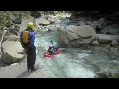
This is a really good clean run with a 5-7 hour marked hiking route in to a hut. If it’s running clear you’ll like it.
It’s a guidebook run Class III with one Class IV, so check out rivers.org.nz for info.
We walked in from the Lyell Saddle. Not a nice way in! Took two days to get to the good stuff.
Here’s a video
and a story:
Roman, good to see that you have the technical nouse and time to put together a “youtube” whilst travelling!
I fished the Mokihinui Sth Br and Nth Br to mid-gorge about 5yrs ago (pre packrafting) . At that stage the South Branch was pretty flat water even for fly-fishing! The Nth Br gorge looked more entertaining, and I reckon a suberb fly-fishing/rafting trip would be to be dropped into the upper Nth Br by chopper (…or walk in, time and ingterest dependent), fish that area, and then raft down through the gorge, fishing sections on the way. The gorge section looked entertaining and enjoyable rafting, with probably only a few portgages.
There certainly are some big boulders etc in the Mok below the forks, aren’t there?! AND…did you guys raft the big drop just below the forks next to the huge boulder, or bypass it??
Sorry we didn’t meet on the Karamea last week- it had risen a fair bit, and I understand why you would not have been keen to walk all the way into Grays to possibly then also have to walk out! We only rafted out from the lower Ugly to the helicopter pick up point a few km downstream, walking the major rapids, and then got a chopper out. It wasn’t very pleasant. Very churned up and brown after that rain.
The Ugly turned out to be essentially unraftable from a practical point of view - the lower 6km or so is pretty much continuous rapids/boulders/drops of varying difficulty, with almost no break between them, except for an occasional pool. Whilst there were some great looking sections, they tended to be short, and there were plenty of random horrible bits. The lack of time available to recover between drops, and difficulty remembering the horrible bits, and being able to get out before them would have made for some extremely stressful and unenjoyable rafting. The sections in their own right would have been fun, but the buggerizing around and portgaging would have been a hassle, particularly in the rain. So, sadly, we probably can claim the first ascent and descent of the Ugly carrying packrafts all the way! On the other side of the coin, we did catch 47 browns averaging a tad over 4lbs, so it certainly wasn’t a wasted trip.
A
This is fantastic. Crossing that slip looked interesting.
How far down the river were you where the actual rafting footage starts (1:17) ? I’m looking at the map now - something I’m still finding tricky is estimating river sizes from it.
We could finally sit in our boats a couple km down from Slate Creek. The water was quite low and changes a lot so pretty hard to tell from the map whether it’ll go.
